


1 Photo
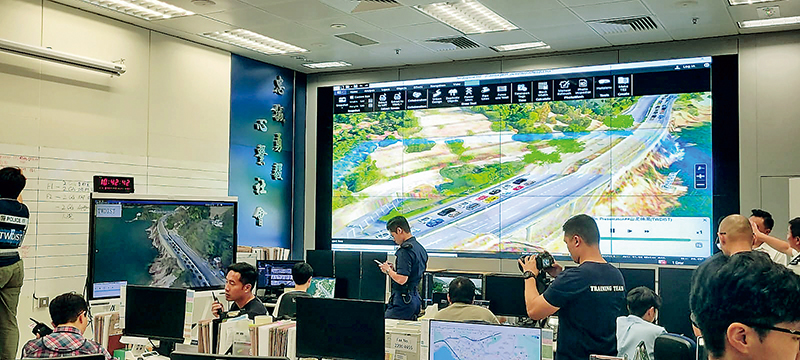
To enhance the Force’s capacity in planning large-scale operations, the Innovation and Solution Lab (ISLAB) of the Information Systems Wing (ISW) is currently developing the Geospatial Analytics, Information and Applications (GAIA), a geographic information system dedicated for the Force. Collaborating respectively with Hong Kong Island in November 2023 and New Territories South in May this year, ISLAB explored the application and practicality of this system in police work.
GAIA provides spatial information of the entire territory in 3D form, displaying various terrains and buildings, including images of indoor maps and pedestrian networks. It replaces the conventional 2D representation to facilitate operational units’ prompt access to relevant geographic information for planning and executing optimal action plans.
GAIA not only improves computational efficiency for smoother usage but also supports terrain data captured from LIDAR. Therefore, in simulating flooding in Tai O area, the system can predict the low-lying areas that are most vulnerable to flooding. The system also incorporates more 3D models, such as different types of vehicles and vessels, to enhance realism and user immersion. The application of GAIA enables various departments to respond to emergencies more effectively, enhancing command capabilities and operational efficiency.