Description
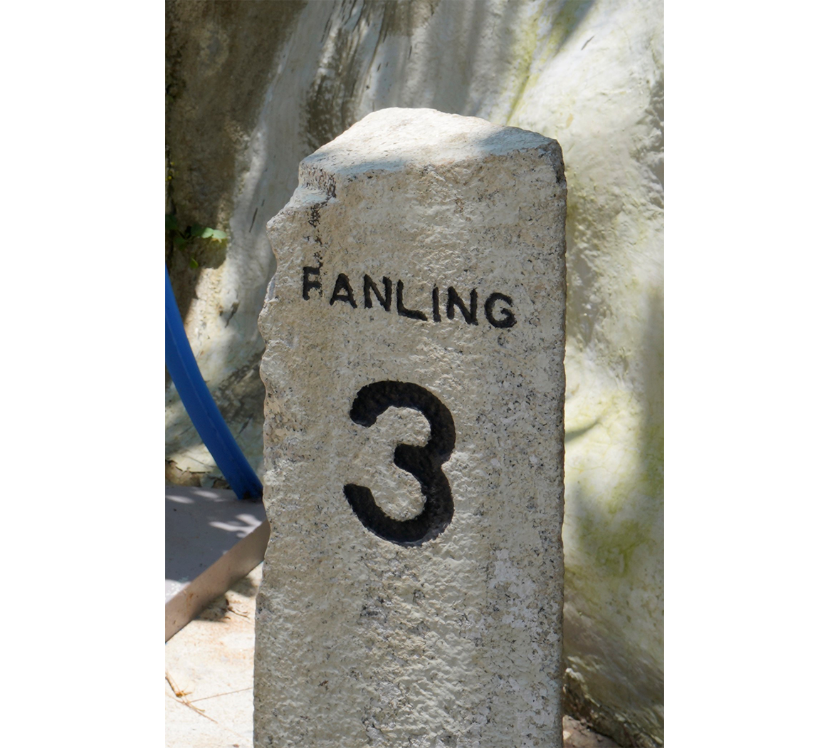
The purpose of boundary stones is to mark territorial boundaries, but they may also provide some clues to Hong Kong’s historical development. For example, Sino-British boundary stones were erected at Chung Ying Street, Sha Tau Kok to demarcate the limit of the British Concession, which remains a legal landmark to date. The granite boundary stone shown here is inscribed with the words "SHA TAU KOK" and "FANLING" in English. It marked the boundary between Sha Tau Kok and Fanling and indicated the direction and distance to both Sha Tau Kok and Fanling. The boundary stone was found beside Sha Tau Kok Road in 1990 and was subsequently transferred to the Police Museum’s collection. The land boundary between Hong Kong and China starts in the east at Starling Inlet and runs on the centre line of Chung Ying Street at Sha Tau Kok and continues down to the mouth of the Shenzhen River at Deep Bay in the west. This boundary was secured by the Rural Patrol Team, which patrolled the rural areas of the New Territories day and night. Established in 1949, the Rural Patrol Team covered nearly 700 remote villages in Hong Kong. The team members had to climb up and down mountains and go deep into remote villages to patrol. Hence, they were dubbed the "pangolins". In the 1970s, when illegal immigration was a serious problem, the Rural Patrol Teams were also tasked with anti-smuggling and anti-burglary duties. Today, there are still Rural Patrol Teams in Sha Tin, Sai Kung, Tai Po and the outlying islands.
